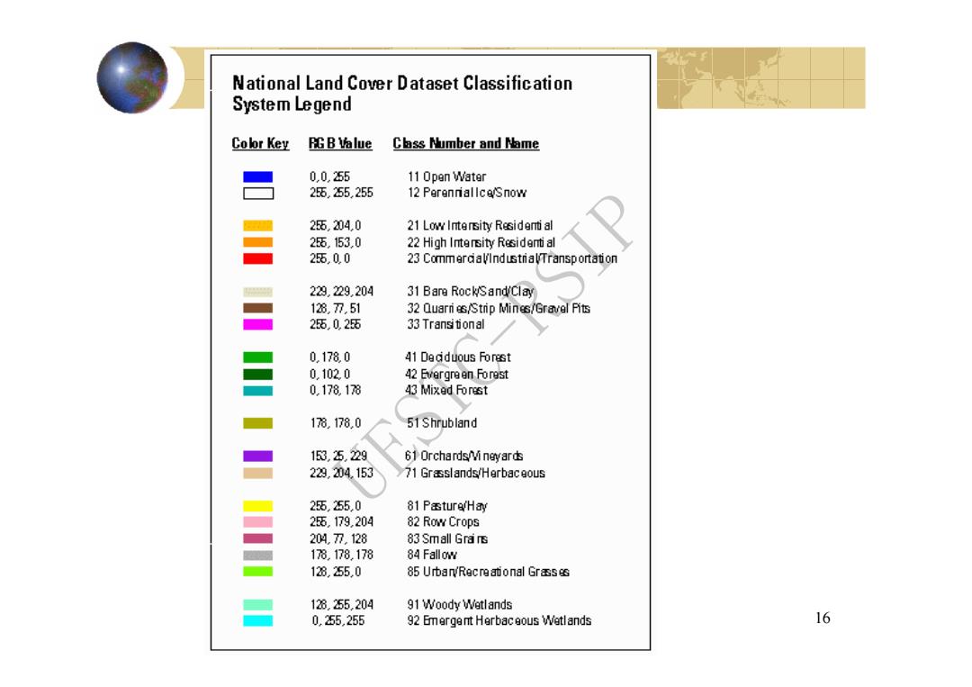
National Land Cover Dataset Classification System Legend Color Key EGB临lue Class Number and Name 0,0.255 11 Open Water 25.255,255 12 Perenriallce/Snow 25,204,0 21 Low Intersity Residert al 25.153.0 22 High Intersity Residenti al 25.00 23 CommerdaVlndustriaVTransportation 223.229.204 31 Bare Rock/Sand/Clay 128.7.51 32 Quarri es/Strip Mines/Gravel Pits 25,0255 33 Transitional 0.1780 41 Dedduous Forest 0.1020 42 Evergreen Forest 0,178.178 43Mi以ed Forest 178.178.0 51 Shrubland 153.25.229 61 Orchards/vi neyards 223,204.153 71 Grasslands/Herbaceous 255.2550 81 Pasture/Hay 25.179,204 82 Row Crops 204.7.128 83 Small Grars 18.178.178 84 Fallow 128.2550 85 UrbarRecreational Grasses 128.255,204 91 Woody Wetlands 0,255255 92 Emergent Herbaceous Wetlands 16
16 UESTC-RSIP
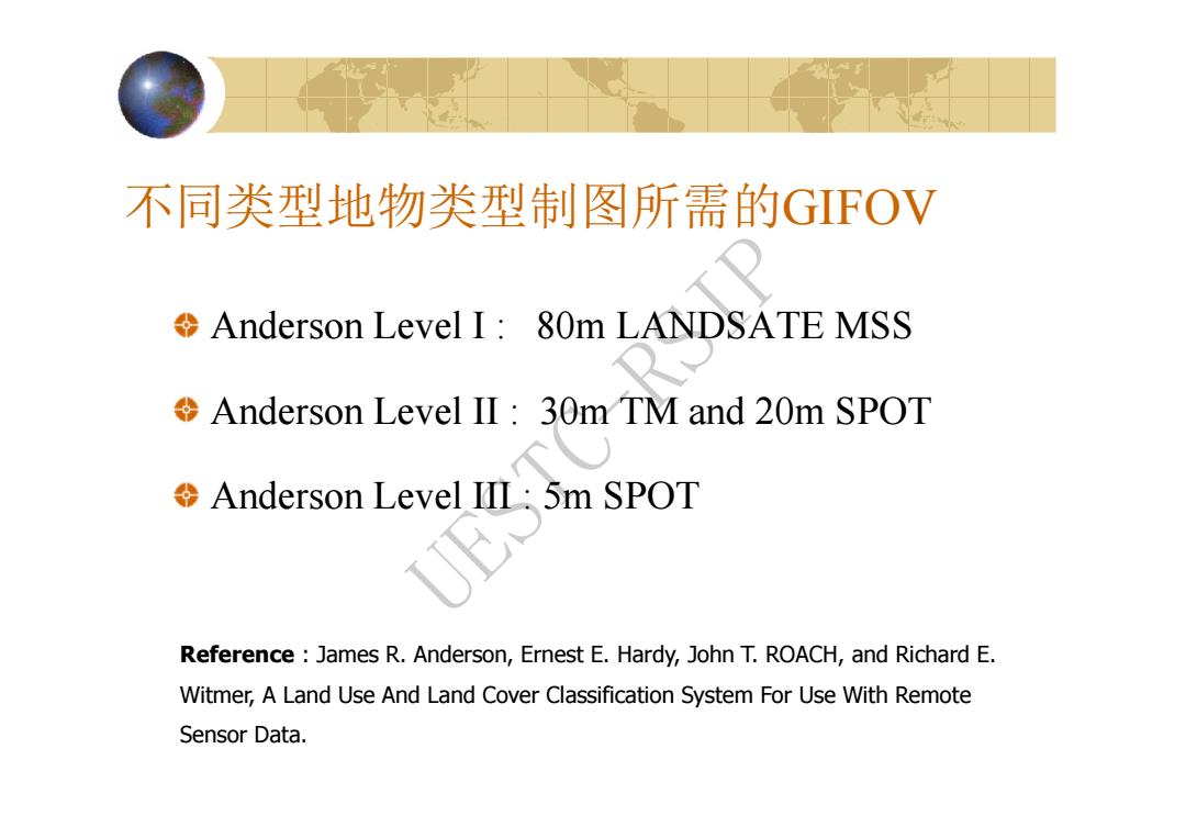
不同类型地物类型制图所需的GFOV Anderson Level I:80m LANDSATE MSS Anderson Level II 30m TM and 20m SPOT Anderson Level III:5m SPOT Reference James R.Anderson,Ernest E.Hardy,John T.ROACH,and Richard E. Witmer,A Land Use And Land Cover Classification System For Use With Remote Sensor Data
不同类型地物类型制图所需的GIFOV Anderson Level I : 80m LANDSATE MSS Anderson Level II : 30m TM and 20m SPOT Anderson Level III : 5m SPOT Reference : James R. Anderson, Ernest E. Hardy, John T. ROACH, and Richard E. Witmer, A Land Use And Land Cover Classification System For Use With Remote Sensor Data. UESTC-RSIP
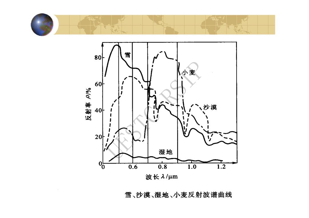
80 雪 小麦 60 40 、沙漠 20 湿地 0.6 0.8 1.0 .2 波长元/μm 雪、沙漠、湿地、小麦反射波谱曲线
UESTC-RSIP
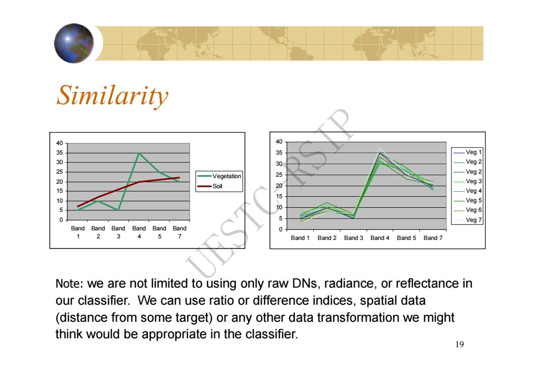
Similarity 40 -Veg 1 350250 Veg 2 -Vegetation Veg 2 Veg 3 15 Soil Veg 4 0 0505050 -Veg 5 Veg 6 0 5 Veg 7 Band BandBandBandBand Band 0 2 3 4 5 7 Band 1 Band 2 Band 3 Band 4 Band 5 Band 7 Note:we are not limited to using only raw DNs,radiance,or reflectance in our classifier.We can use ratio or difference indices,spatial data (distance from some target)or any other data transformation we might think would be appropriate in the classifier. 19
19 Similarity 0 5 10 15 20 25 30 35 40 Band 1 Band 2 Band 3 Band 4 Band 5 Band 7 Vegetation Soil 0 5 10 15 20 25 30 35 40 Band 1 Band 2 Band 3 Band 4 Band 5 Band 7 Veg 1 Veg 2 Veg 2 Veg 3 Veg 4 Veg 5 Veg 6 Veg 7 Note: we are not limited to using only raw DNs, radiance, or reflectance in our classifier. We can use ratio or difference indices, spatial data (distance from some target) or any other data transformation we might think would be appropriate in the classifier. UESTC-RSIP
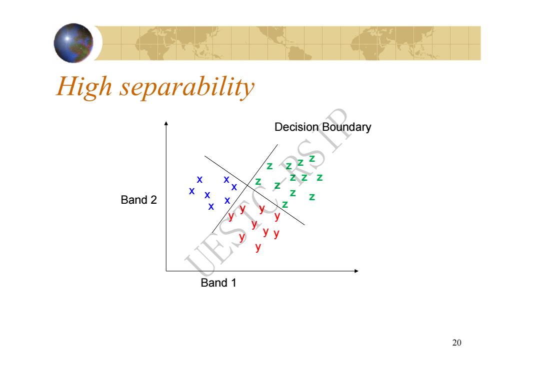
High separability Decision Boundary Band 2 Band 1 20
20 x x x x x y y y y y Band 1 Band 2 x x y y y y z z z z z z z z z z z z Decision Boundary High separability UESTC-RSIP