第一章 8 遥感图像处理基础 1
1 第一章 遥感图像处理基础 UESTC-RSIP

第一颗陆地卫星:1972年,Landsat Multispectral Scanner System(MSS).4个波 段,波谱宽度100nm,像元大小80米。 Dubai January 22,1973 Dubai October 11,2006 Landsat 1 MSS Landsat 7 ETM+bands 4,3,2 2
2 第一颗陆地卫星:1972年, Landsat Multispectral Scanner System (MSS). 4个波 段,波谱宽度100nm,像元大小80米。 Dubai - January 22,1973 Landsat 1 MSS Dubai - October 11, 2006 Landsat 7 ETM+ bands 4, 3, 2 UESTC-RSIP
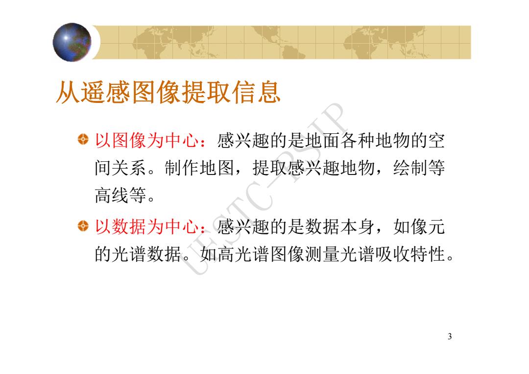
从遥感图像提取信息 以图像为中心:感兴趣的是地面各种地物的空 间关系。制作地图,提取感兴趣地物,绘制等 高线等。 以数据为中心:感兴趣的是数据本身,如像元 的光谱数据。如高光谱图像测量光谱吸收特性。 3
3 从遥感图像提取信息 以图像为中心:感兴趣的是地面各种地物的空 间关系。制作地图,提取感兴趣地物,绘制等 高线等。 以数据为中心:感兴趣的是数据本身,如像元 的光谱数据。如高光谱图像测量光谱吸收特性。 UESTC-RSIP
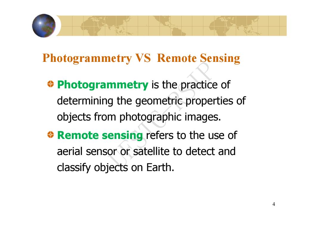
Photogrammetry VS Remote Sensing Photogrammetry is the practice of determining the geometric properties of objects from photographic images. Remote sensing refers to the use of aerial sensor or satellite to detect and classify objects on Earth. 4
4 Photogrammetry VS Remote Sensing Photogrammetry is the practice of determining the geometric properties of objects from photographic images. Remote sensing refers to the use of aerial sensor or satellite to detect and classify objects on Earth. UESTC-RSIP
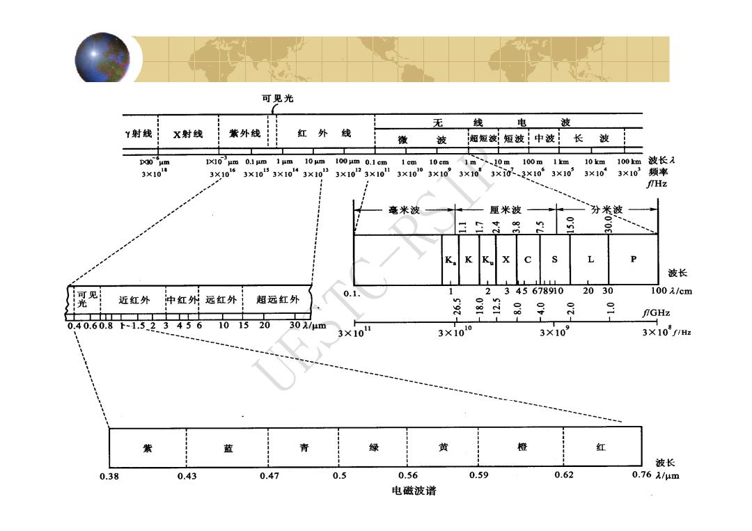
可见光 无 线 电 波 Y射线 X射线 紫外线 红外线 微 波 超短波;短波!中波 长波 D0 um 1um 10 um 100 jm 0.1 cm 1 cm 10cm 1m、、10m 100m1m 10km :100km波长 3×101塘 3X10⁶ 3×1053×10“3×1033×1023×10 3×10¹⁰ 310” 3×10 3×i0、3×10 3×10³ 3×10 3×10³频率 fHz 毫米波 厘米波 分米波 n K K X P 波长 可见 0.1. 1 2345678910 2030 100元/cm 光 近红外 中红外远红外 1 超远红外 n 9 二 fGHz 0.40.60.8下-1.523456 101520 30λ/μm 3×10 3×10¹⁰ 3×10⁹ 3×10f1H 紫 蓝 青 绿 黄 橙 红 波长 0.38 0.43 0.47 0.5 0.56 0.59 0.62 0.761/μm 电磁波谱
5 UESTC-RSIP