第七章 P R 遥感图像分类 1
1 第七章 遥感图像分类 UESTC-RSIP
专题分类 A thematic map shows the spatial distribution of identifiable earth surface features;it provides an informational description over a given area,rather than a data description. Image classification is the process used to produce thematic maps from imagery.The themes can range, for example,from categories such as soil,vegetation, and surface water in a general description of a rural area,to different types of soil,vegetation,and water depth or clarity for a more detailed description. 2
2 专题分类 A thematic map shows the spatial distribution of identifiable earth surface features; it provides an informational description over a given area, rather than a data description. Image classification is the process used to produce thematic maps from imagery. The themes can range, for example, from categories such as soil, vegetation, and surface water in a general description of a rural area, to different types of soil, vegetation, and water depth or clarity for a more detailed description. UESTC-RSIP

Thematic maps (Rondonia,Brazil) Altitude(m) Current vegetation 8 10 11 .11 12 -12 -13 -13 -54 -83 62 51 80 86 84 -63 -62 61 60 Longttude (degrees) Longttude (degrees) 3
3 Thematic maps (Rondonia, Brazil ) UESTC-RSIP
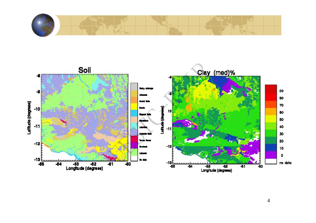
Soil -8 Clay (med)% 10 -12 000WS00000 -12 : -13 6 64 -63 82 81 60 -13 no data Longtuda (degrees) 64 -63 2 81 Longituda (dagroas) 4
4 UESTC-RSIP
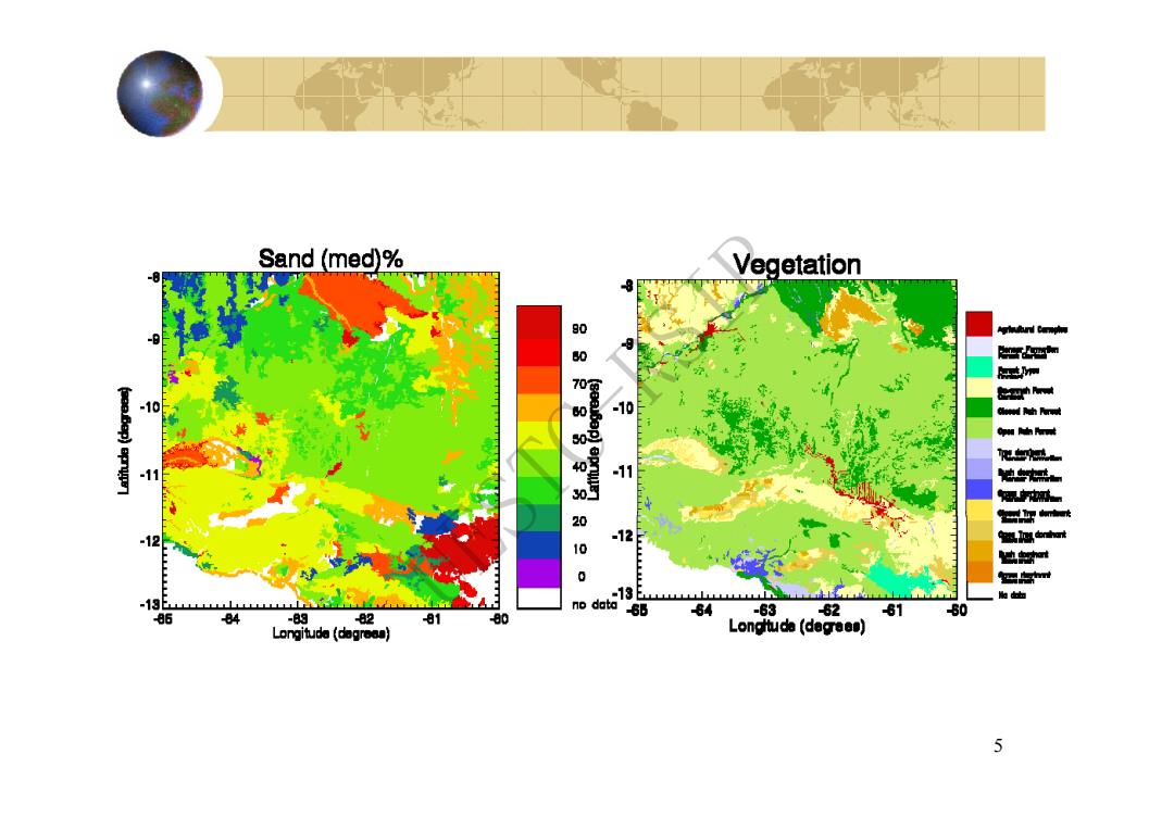
Sand (med)% Vegetation 80 0 -10 11 -12 0 -13 no 13 dat 50 86 84 -8g 82 81 80 84 -63 62 81 Longitude (dogresa) Longttuda (decrees) 5
5 UESTC-RSIP