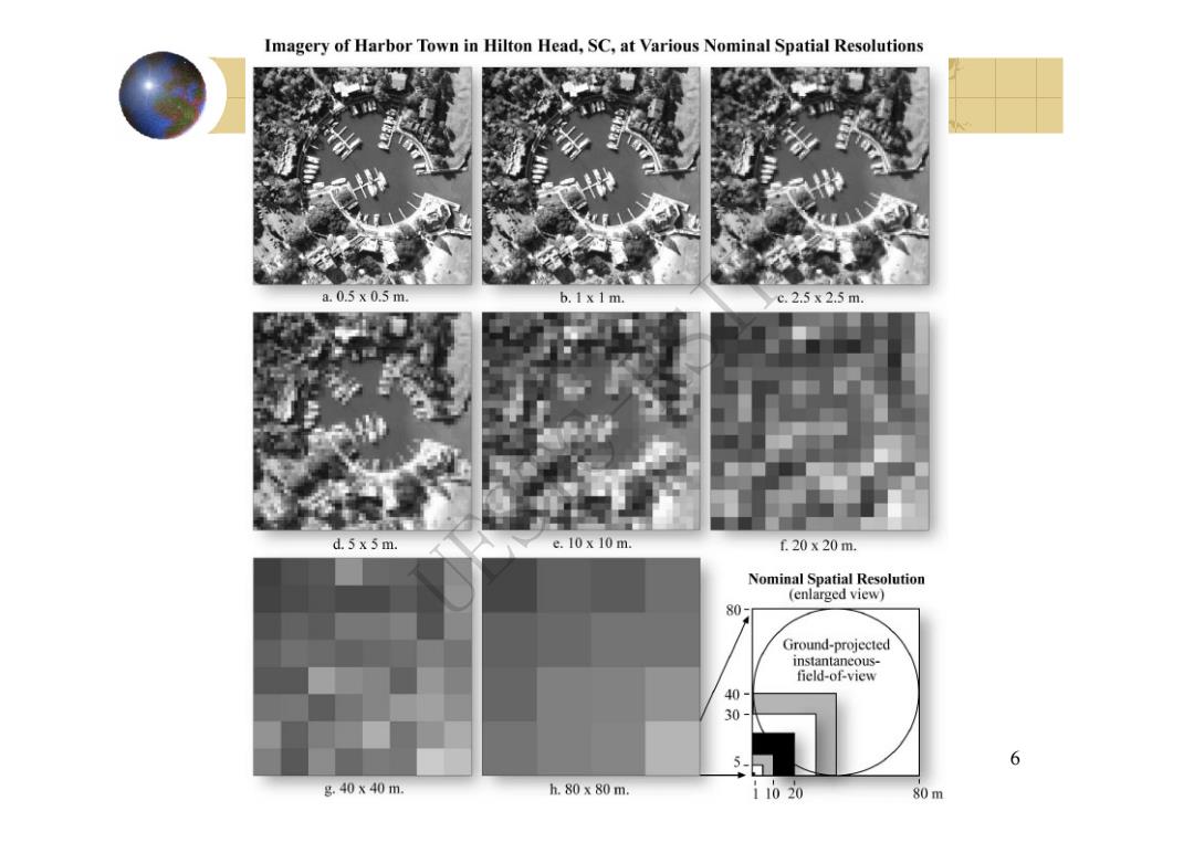
Imagery of Harbor Town in Hilton Head,SC,at Various Nominal Spatial Resolutions a.0.5x0.5m b.I x 1 m. c.2.5x2.5m. 。 d.5 x 5 m. e.10x10m f20x20m. Nominal Spatial Resolution (enlarged view) 80 Ground-projected instantaneous- field-of-view 30 5- 6 g.40x40m. h.80x80m. i1020 80m
6 UESTC-RSIP
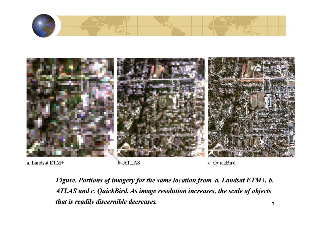
a.Landsat ETM+ b.ATLAS c.QuickBird Figure.Portions of imagery for the same location from a.Landsat ETM+,b. ATLAS and c.QuickBird.As image resolution increases,the scale ofobjects that is readily discernible decreases. 7
7 Figure. Portions of imagery for the same location from a. Landsat ETM+, b. ATLAS and c. QuickBird. As image resolution increases, the scale of objects that is readily discernible decreases. UESTC-RSIP

8
8 UESTC-RSIP
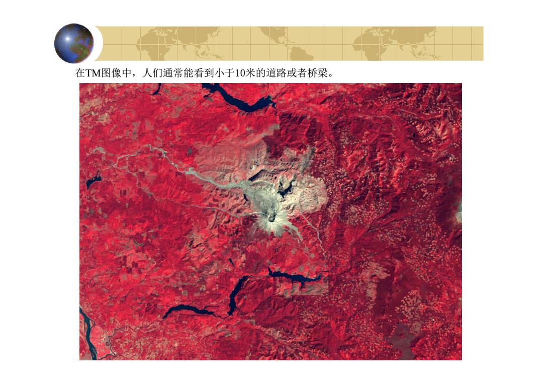
在TM图像中,人们通常能看到小于10米的道路或者桥梁
在TM图像中,人们通常能看到小于10米的道路或者桥梁。 UESTC-RSIP
实际的图像中能够被检测出来的最 小目标物不仅与遥感图像的空间分辨率 (GSI/GIFOV)有关,还与目标和背景的辐 射对比度相关。 10
实际的图像中能够被检测出来的最 小目标物不仅与遥感图像的空间分辨率 (GSI/GIFOV)有关,还与目标和背景的辐 射对比度相关。 10 UESTC-RSIP