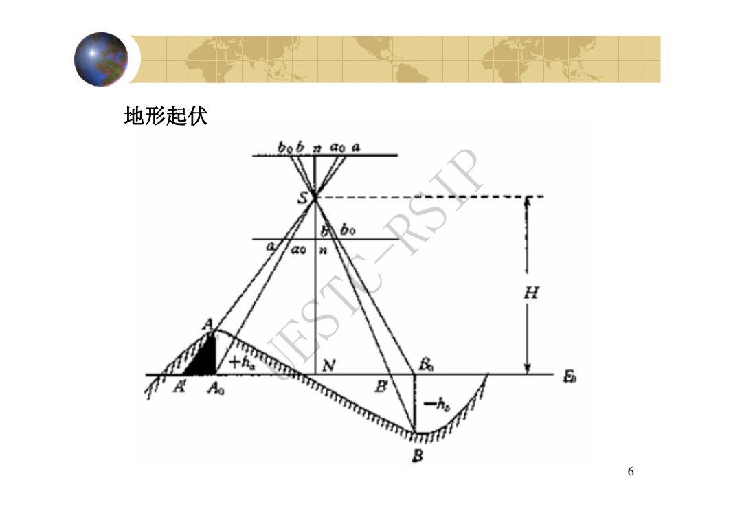
地形起伏 bob n ao a bo 40 H 十h。 岛 E A Ao %7777 B B 6
6 地形起伏 UESTC-RSIP
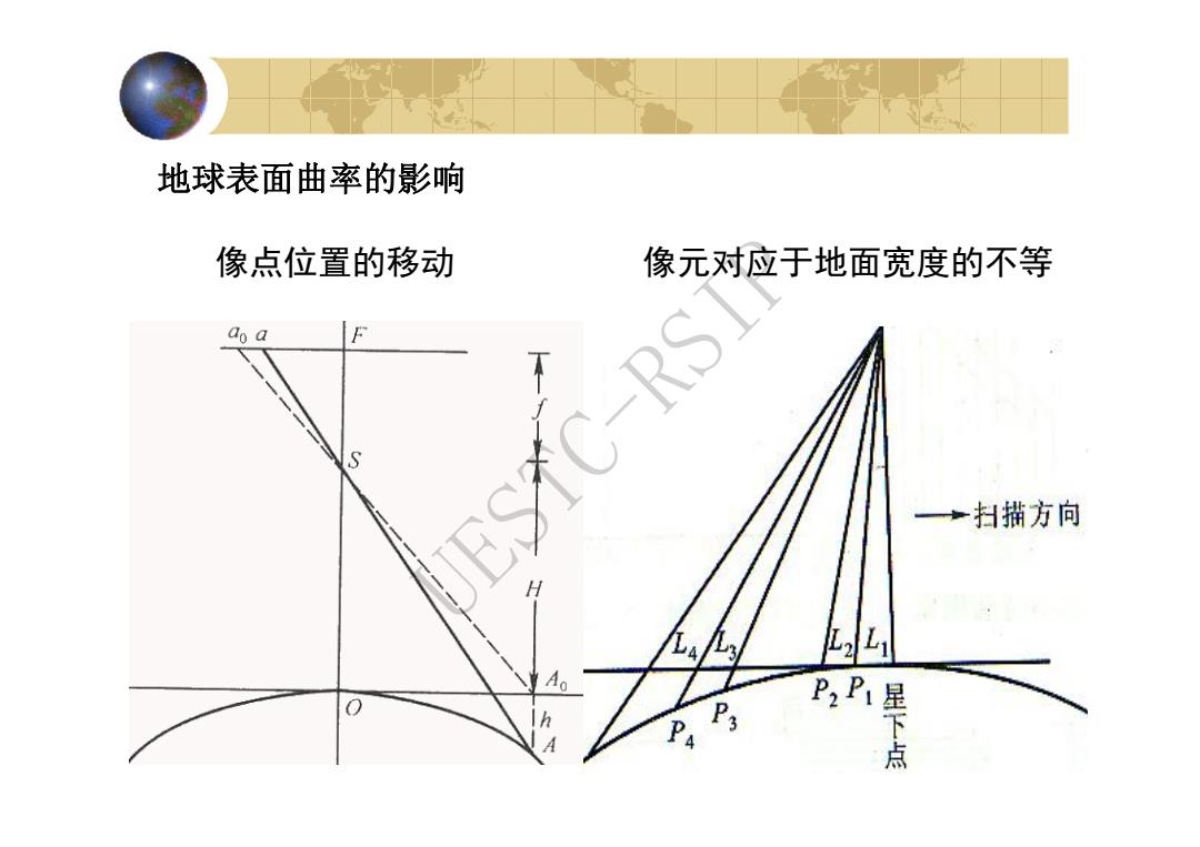
地球表面曲率的影响 像点位置的移动 像元对应于地面宽度的不等 an a F S 产扫描方向 4九3/ L,Li Ao h P3 9卫斜
7 地球表面曲率的影响 像点位置的移动 像元对应于地面宽度的不等 UESTC-RSIP
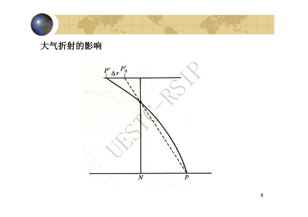
大气折射的影响 △r RSIP UES N P 8
8 大气折射的影响 UESTC-RSIP
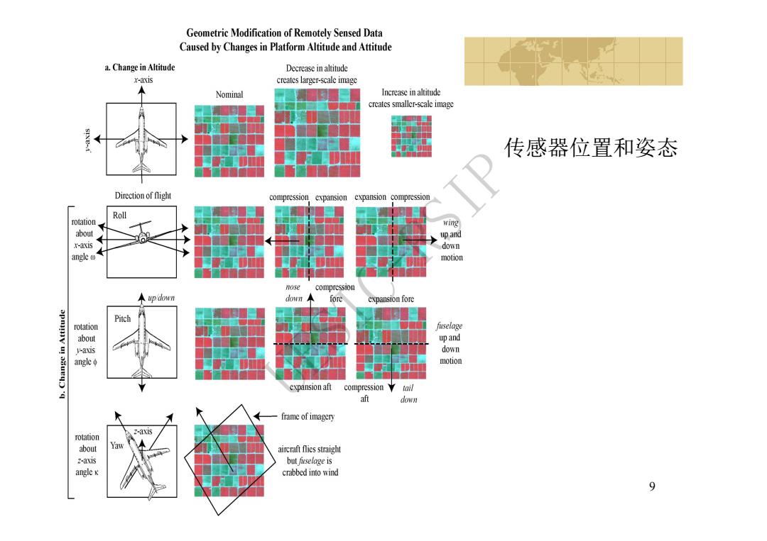
Geometric Modification of Remotely Sensed Data Caused by Changes in Platform Altitude and Attitude a.Change in Altitude Decrease in altitude x-axis creates larger-scale image Nominal Increase in altitude creates smaller-scale image SIXE- 传感器位置和姿态 Direction of flight compression expansion expansion compression Roll rotation wing abo川 up and x-axis down angle motion nose compression ←pdown downA fore expansion fore Pitch rotation fuselage about up and V-axis down angle motion expansion aft compression tail aft down frame of imagery 2-axis rotation about Yaw aircraft flies straight z-axis but fuselage is angle x crabbed into wind 9
9 传感器位置和姿态 UESTC-RSIP
10 UESTC-RSIP