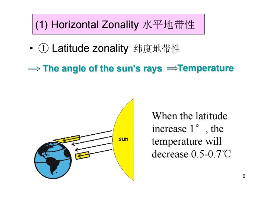
(1)Horizontal Zonality水平地带性 ①Latitude zonality纬度地带性 The angle of the sun's rays -Temperature When the latitude increase1°,the sun temperature will decrease0.5-0.7℃ 6
6 (1) Horizontal Zonality 水平地带性 • ① Latitude zonality 纬度地带性 The angle of the sun's rays The angle of the sun's rays Temperature Temperature When the latitude increase 1 °, the temperature will decrease 0.5-0.7 ℃
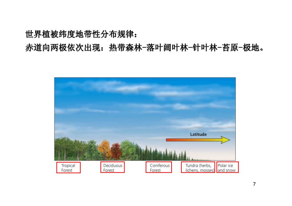
世界植被纬度地带性分布规律: 赤道向两极依次出现:热带森林-落叶阔叶林-针叶林-苔原-极地。 Latitude Tropical Deciduous Coniferous Tundra (herbs, Polar ice Forest Forest Forest lichens,mosses)and snow 7
7 世界植被纬度地带性分布规律: 世界植被纬度地带性分布规律: 赤道向两极依次出现:热带森林 赤道向两极依次出现:热带森林 -落叶阔叶林 -针叶林 -苔原 -极地
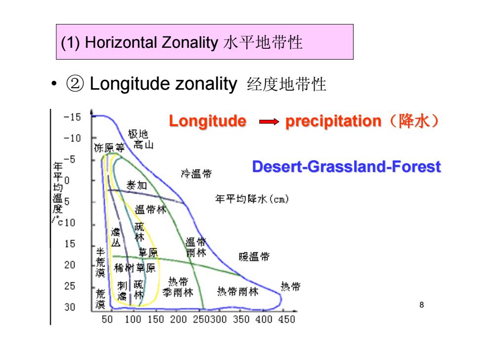
(1)Horizontal Zonality水平地带性 ②Longitude zonality 经度地带性 -15 Longitude precipitation (降水) -10 极地 冻原等料高山 平 冷温带 Desert-Grassland-Forest 恭加 年平均降水(cm) 度 温带林 c10 腰 15 丛 温微 草原 丽 暖温带 20 漠 稀附草原 25 刺 疏 热带 季丽林 热带雨林 热带 30 蒸 8 50 100150200 250300350400450
8 (1) Horizontal Zonality 水平地带性 • ② Longitude zonality 经度地带性 Longitude Longitude precipitation precipitation(降水) Desert -Grassland Grassland -Forest
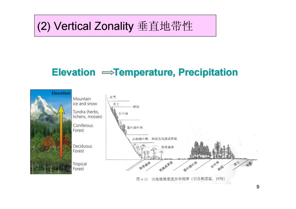
(2)Vertical Zonality垂直地带性 Elevation -Temperature,Precipitation Elevation Mountain ice and snow 一树线 Tundra (herbs, 针叶林 lichens,mosses) Coniferous 落叶叶林 Forest 山地阔叶林,问邮为荒漠或草敞 Deciduous 热查林 Forest Tropical Forest 漠或草原 落叶叶林 针林 树 图411山地植被垂直分布规律(引自郝道猛,1978) 9
9 (2) Vertical Zonality 垂直地带性 Elevation Elevation Temperature, Precipitation Temperature, Precipitation
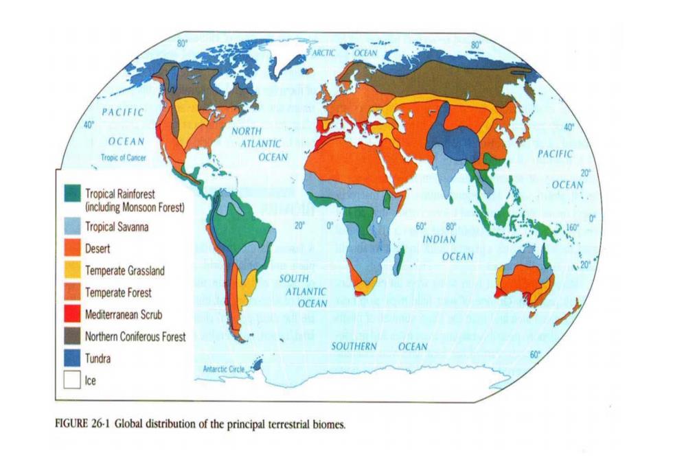
80 PACIFIC 40 NORTH OCEAN ATLANTIC TropicofCancer OCEAN PACIFIC 20 OCEAN Tropical Rainforest including Monsoon Forest) Tropical Savanna 6080 INDIAN Desert OCEAN Temperate Grassland 2 SOUTH Temperate Forest ATLANTIC OCEAN Mediterranean Scrub Northern Coniferous Forest SOUTHERN OCEAN Tundra Antarctic Circle Ice FIGURE 26-1 Global distribution of the principal terrestrial biomes
10