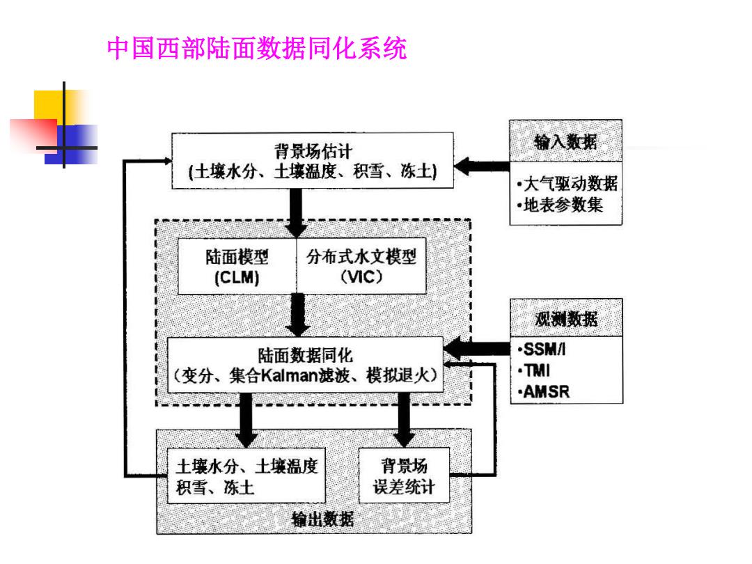
中国西部陆面数据同化系统 背景场估计 输入数据 (土壤水分、土壤温度、积雪、冻土) ·大气驱动数据 ·地表参数集 陆面模型 分布式水文模型 (CLM) (c) 观测数据 陆面数据同化 .SSM/ (变分、集合Kalman:滤波、模拟退火) ·TMI ·AMSR 土壤水分、土壤温度 背景场 积雪、冻土 误差统计 输出数据
中国西部陆面数据同化系统

5.3基于数据同化原理的地表参数反演 Knowledge database module Multiple Using EOS data products satellite observations Data Assimilation Module Optimization NO Convergence? YES Generating Land surface products Sensor characterization module (multiple sensors) Radiative transfer modeling module Adjusting surface atmospheric parameter sets
5.3 基于数据同化原理的地表参数反演

Remote sensing observations Assimilation algorithm time Radiative transfer models Land dynamic model
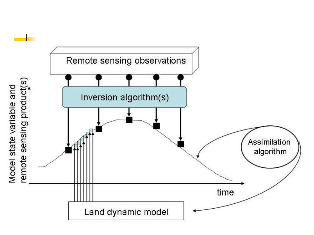
Remote sensing observations Inversion algorithm(s) Assimilation algorithm time Land dynamic model
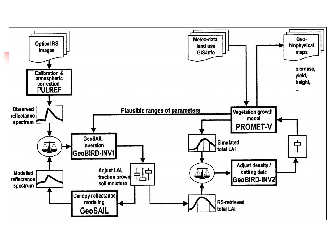
Meteo-data, Geo- Optical RS land use biophysical images GIS-Info maps biomass, Calibration atmospheric yield, correction height, PULREF Observed Plausible ranges of parameters Vegetation growth reflectance model spectrum PROMET-V GeoSAlL Simulated inversion total LAI 宁 GeoBIRD-INV1 Adjust density/ Modelled Adjust LAI, cutting date reflectance fraction brown 宁 GeoBIRD-INV2 spectrum soil moisture Canopy reflectance modeling RS-retrieved GeoSAIL total LAI