
植被遥感参数反演 遥感物理模型方法 基于ACRM模型和查找表算法的植被叶面积指数反演 Materails and Lnd大TM Result Data processing Unit Range or LIT product Parameters Sym bol fixed d LAI mapping value Price information (Ficld rescarch) data o1r6g有 (6S+MOOTRAN) Sun zenith angle (°) 8 20.72 Model The Au/ferra MODIS Surface 格/6dete View zenith angle (°) 6 4 act6T国 LAI Relative azimuth angle (°) 218.24 comparison Angstrom turbidity coefficient B 0.12 Retrieval scheme The mean value of retrievod LAl 5 ensitive ana小s of major model input parameters Input parameters of ACRM LAI 0-9 0.1 Leaf area index Retrieved LAl LAlg 0.05 LAI of ground level ACRM ridiative Mean leaf angle of Merit function the elliptical LAD 57.3 Hot spot parameter 0.5/LAI 4 Set up LUT Markov clumping parameter S 0.4-1.0 0.2 0.05 Weight of the first basis function S 0.05-0.5 and 0.02 Claification Look-up table Look-up table hased cn for reed dense foe reed spurse tatisic NDV司 细 销 Leaf mesophyll structure N 1.0-2.4 0.2 Chlorophyll a+b content μg 30-90 Leaf equivalent water thickness cm-2 10 cm Cw 0.015 Dry matter content 40-110 10 Brown pigment gm2 Cup 0.4
植被遥感参数反演 遥感物理模型方法 基于ACRM模型和查找表算法的植被叶面积指数反演 Parameters Unit s Sym bol Range or fixed value dx Sun zenith angle (°) s 20.72 View zenith angle Relative azimuth angle Angstrom turbidity coefficient (°) (°) v raz β 4 218.24 0.12 Leaf area index LAI of ground level LAI LAIg 0-9 0.05 0.1 Mean leaf angle of the elliptical LAD Hot spot parameter Markov clumping parameter (°) l SL Sz 57.3 0.5/LAI 0.4-1.0 0.2 Weight of the first basis function S1 0.05-0.5 0.05 and 0.02 Leaf mesophyll structure Chlorophyll a+b content Leaf equivalent water thickness Dry matter content Brown pigment g cm-2 cm g m-2 N Cab CW Cm Cbp 1.0-2.4 30-90 0.015 40-110 0.4 0.2 10 10
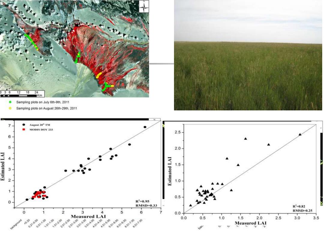
121824 ■Km Sampling plots on July 6th-9th,2011 Sampling plots on August 26th-29th 2011 Agut20”TM ● MODIS DOV 233 2.5 6 5 2.0 4- IVI pajewns3 1.5 1.0 0.5 R-0.95 RMSD-0.33 R2-0.82 0 2 3 4 5 6 0.0 RMSD-0.25 Measured LAI 05140 30 2513 354a 0.0 0.5 1.0 1.5 2.0 2.5 3.0 3.5 021050 151200 201250 451500 65t600 650-700 601 651.700 Measured LAI
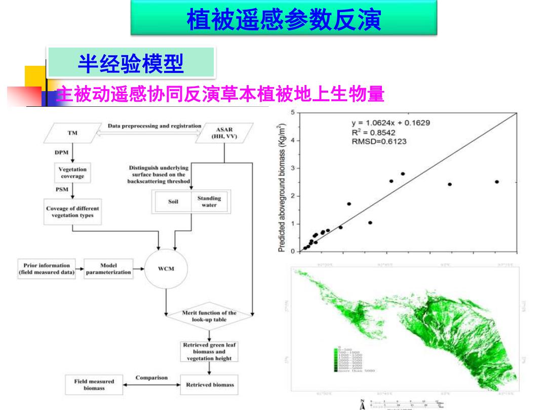
植被遥感参数反演 半经验模型 主被动遥感协同反演草本植被地上生物量 Data preprocessing and registration y=1.0624x+0.1629 ASAR T (HH.VV) R2=0.8542 RMSD=0.6123 DPM Vegetation Distinguish underlying 3 coverage surface based on the backscattering threshod PSM Standing 2 water Coveage of differen vegetation types Prior information Model WCM (fleld measured data) parameterization Merit function of the look-up table Retrieved green leaf biomass维nd vegetation height Field measured Comparison Retrieved hiomass biomass 士,,生
植被遥感参数反演 半经验模型 主被动遥感协同反演草本植被地上生物量

植被遥感应用 口服务信息 生态环境综合评价系统 产品缩略图: 园制坑数州岸国 问3 产品名称: landuse 生态环境综合评价系统 产品类型: MapServer Ecological Environment Comprehensive Evaluation System 产品时间: 2013年6月20日 所混地区: 中国四川省若尔盖地区 用户名:wny 密码: 年布中年 描述信息: 土地利用图 登陆 确定 多的 w
植被遥感应用 生态环境综合评价系统
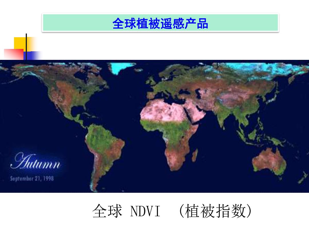
全球植被遥感产品 58时ember21,1998 全球DVI (植被指数)
全球 NDVI (植被指数) 全球植被遥感产品