所有分类
教育科研
办公文档
商业经管
专业资料
其他分类
教育科研
办公文档
商业经管
专业资料
其他分类
全部格式
Word文档
Excel表格
Powerpoint幻灯片
Adobe PDF
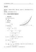
兰州交通大学:《交通工程测量》课程授课教案(打印版)5.4-5.6
兰州交通大学:《交通工程测量》课程授课教案(打印版)5.4-5.6
文件格式: PDF
大小: 658.6KB
页数: 5
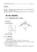
兰州交通大学:《交通工程测量》课程授课教案(打印版)5.4-5.6
兰州交通大学:《交通工程测量》课程授课教案(打印版)5.4-5.6
文件格式: PDF
大小: 658.6KB
页数: 5
兰州交通大学:《交通工程测量》课程授课教案(打印版)5.1-5.3
兰州交通大学:《交通工程测量》课程授课教案(打印版)5.1-5.3
文件格式: PDF
大小: 258.97KB
页数: 3
兰州交通大学:《交通工程测量》课程授课教案(打印版)4.5
兰州交通大学:《交通工程测量》课程授课教案(打印版)4.5
文件格式: PDF
大小: 264.85KB
页数: 2
兰州交通大学:《交通工程测量》课程授课教案(打印版)4.4
兰州交通大学:《交通工程测量》课程授课教案(打印版)4.4
文件格式: PDF
大小: 574.29KB
页数: 3
兰州交通大学:《交通工程测量》课程授课教案(打印版)4.1-4.3
兰州交通大学:《交通工程测量》课程授课教案(打印版)4.1-4.3
文件格式: PDF
大小: 1.1MB
页数: 6
兰州交通大学:《交通工程测量》课程授课教案(打印版)3.4
兰州交通大学:《交通工程测量》课程授课教案(打印版)3.4
文件格式: PDF
大小: 676.35KB
页数: 4
兰州交通大学:《交通工程测量》课程授课教案(打印版)3.1-3.3
兰州交通大学:《交通工程测量》课程授课教案(打印版)3.1-3.3
文件格式: PDF
大小: 1.47MB
页数: 8
兰州交通大学:《交通工程测量》课程授课教案(打印版)2.4-2.5
兰州交通大学:《交通工程测量》课程授课教案(打印版)2.4-2.5
文件格式: PDF
大小: 1.22MB
页数: 5
兰州交通大学:《交通工程测量》课程授课教案(打印版)1.1-2.3
兰州交通大学:《交通工程测量》课程授课教案(打印版)1.1-2.3
文件格式: PDF
大小: 771.37KB
页数: 4
首页
上页
45
46
47
48
49
50
51
52
下页
末页
高职:《测量学基础》课程教学资源(案例)案例2 某大学学生活动中心工程测量施工方案
同济大学:《现代大地控制测量》课程教学课件(PPT讲稿)第六章 高程控制网的建立(6-3)国家与工程精密水准网的测设与平差计算
新疆大学:《遥感地学分析》课程教学大纲 Remote sensing geological analysis
河南城建学院:《交通土建工程测量》课程教学资源(PPT课件)第二章 水准测量
石河子大学:《遥感导论》课程教学资源(PPT课件)第六章 航天遥感
《测量学》课程教学资源(PPT课件)第七章 小地区控制测量
石河子大学:《遥感导论》课程教学资源(PPT课件)第七章 微波遥感(Microwave RS)
石河子大学:《遥感导论》课程教学资源(PPT课件)第九、十、十一章 遥感图像目视判读、计算机信息提取、遥感技术应用
新疆大学:《工程测量》课程教学资源(PPT课件)第7章 控制测量
中华人民共和国国家标准:国家一、二等水准测量规范(GB/T 12897-2006)Specifications for the first and second order leveling
武汉大学:《摄影测量学》课程教学资源(PPT课件)第9章 无人机摄影测量
©2026 mall.hezhiquan.com 和泉文库
帮助
反馈
侵权